Pedestrian and Bicycle Committee
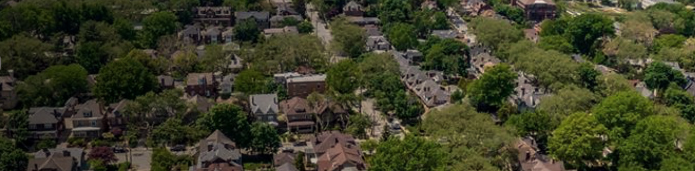
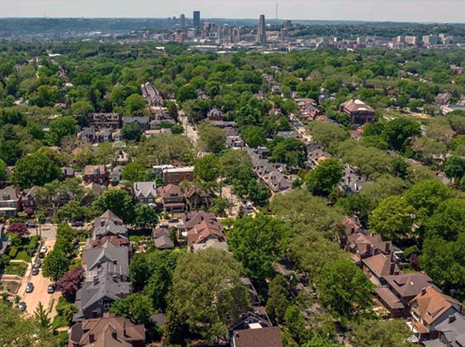
Highly walkable, welcoming and accessible, Squirrel Hill hosts a striking array of social, educational, and cultural amenities, with a strong business base. Schenley Park, Frick Park and Mellon Park form its borders. Home to many diverse students of Pittsburgh, Carnegie Mellon, Chatham, and other fine universities, as well as long-term residents and newcomers, the neighborhood offers both human vibrancy and natural beauty.
Port Authority of Allegheny County (PAT) transit routes serving Squirrel Hill and various points on this walking map include the following: 61A, 61B, 61C, 61D, 64, 65, 74, & 93.
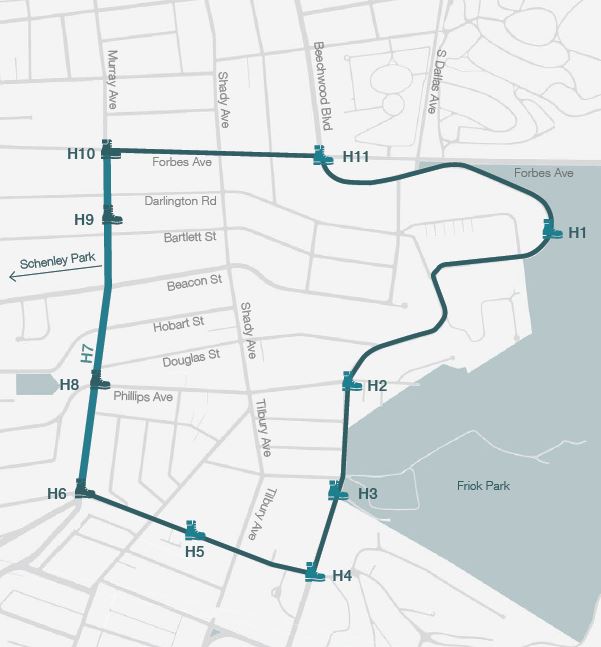
H1 Frick Environmental Center (FEC) & Restored Gatehouses
H2 Pittsburgh Colfax K-8 Public School
H3 Blue Slide Playground
H4 Gary & Nancy Tuckfelt “Keeping Tabs” Holocaust Memorial Sculpture
H5 Pittsburgh Allderdice High School
H6 Forward/Murray/Pocusset Intersection
H7 Murray Avenue Business Corridor
H8 O’Connor’s Corner
H9 Squirrel Hill Post Office, Historical Mural, & Parklet; Manor Theater
H10 Forbes/Murray Intersection
H11 Chabad of Squirrel Hill
This walk begins at Highlight 1, Frick Environmental Center (FEC), but there are many other possible points of entry along the route.
0.00 mi. – From H1, head southwest onto Beechwood Blvd.
0.12 mi. – Continue west on Beechwood Blvd. toward Shaw Ave.
0.42 mi. – Continue west on Beechwood Blvd. toward Philips Avenue (H2).
0.72 mi. – Head south on Beechwood Blvd. to Blue Slide Playground (H3/A). Continue to Forward Ave.
0.88 mi. – Continue on Beechwood through traffic signal to second crosswalk. Safely cross Beechwood and find path to “Keeping Tabs” Memorial (H4/B).
1.00 mi. – After visiting “Keeping Tabs,” follow path down to Forward and turn left on that sidewalk. Continue along Forward to traffic signal at Tilbury Ave. to cross Forward. Continue west on Forward noting Taylor Allderdice High School (H5/C).
1.40 mi. – Continue west on Forward toward Murray Ave. (H6; H7/D) Turn right onto Murray Ave. and continue north, to Phillips Ave. Use traffic signal to cross Murray to visit O’Connor’s Corner (H8) and then Squirrel Hill Post Office and amenities (H9). Continue north to Forbes Avenue.
1.98 mi. – Turn right, onto Forbes Ave. (H10/E), toward Shady Ave.
2.24 mi. – Continue on Forbes to Beechwood Blvd., Chabad of Squirrel Hill (H11/F & G).
2.39 mi. – Turn right; continue on sidewalk to Beechwood Blvd. and Beacon Street (H). Remaining on sidewalk, carefully cross Beacon, and continue to the high-visibility (HV) crosswalk at Shaw Ave. You will see FEC across Beechwood (H).
2.60 mi. – Use this HV crosswalk to safely cross Beechwood and return to FEC (I).


The In a Nutshell! newsletter brings you what's going on in and around Squirrel Hill.
Enter your email address to subscribe to our newsletter and receive notifications of new posts by email.
this is a test
this is a test