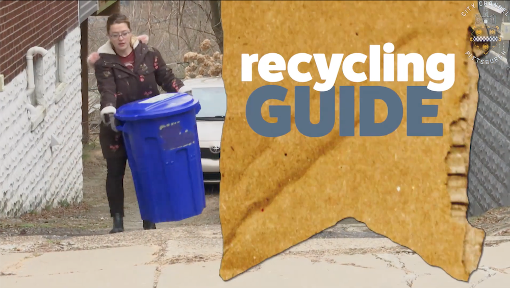
Recycling Changes in Pittsburgh
March 7, 2024
Potential Pedestrian-Bicycle Route to Improve Transportation Access in Greenfield and Squirrel Hill, and Provide Access Through Buncher Site
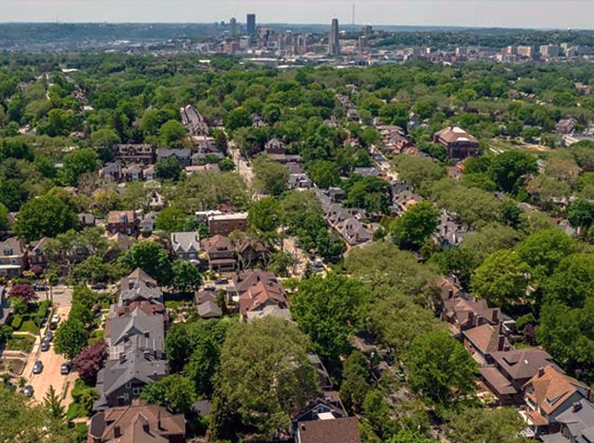
Squirrel Hill
Potential Pedestrian-Bicycle Route to Improve Transportation Access in Greenfield and Squirrel Hill, and Provide Access Through Buncher Site
Squirrel Hill Urban Coalition is pursuing a new pedestrian-bicycle route that would connect southern Squirrel Hill/eastern Greenfield with Saline Street in The Run section of Greenfield.
The purpose is for walkers and bicyclists to have access to the Eliza Furnace Trail as well as be able to reach Downtown Pittsburgh, Oakland, Southside Works, Pittsburgh Technology Center, Hazelwood and the new Almono development in Hazelwood.
The suggested benefits of a new pedestrian-bicycle route are:
This paper covers the following sections:
Background
Improved pedestrian connections and a walkable and bikeable environment for the Forward-Murray-Pocusset (F-M-P) intersection and vicinity have been suggested by multiple previous planning efforts for the area: The Gateway Plan of 2009 and Envisioning the Forward-Murray Gateway report by Carnegie Mellon graduate architecture students in 2014. These are in addition to previous planning efforts dating back to before 1990 that supported economic development in the area designed at a pedestrian scale.
In 2015, in response to citizen requests, SHUC formed a Pedestrian-Bicycle Committee in order to provide a forum for citizens to identify and discuss potential actions that should be considered to improve conditions for pedestrians and bicyclists in Squirrel Hill and nearby areas. Greenfield Community Association (GCA) has been participating with SHUC in working with the committee.
The Committee supported the pedestrian-bicycle trail idea as a potentially attractive transportation improvement.
Where Would the New Route Be Located?
The following figure shows where the potential new route would be located in relation to Squirrel Hill and Greenfield. The route would begin east of the F-M-P intersection and connect with Saline Street in The Run section of Greenfield. By connecting there with existing bicycle and pedestrian facilities, the route would provide multimodal access to the areas described earlier.
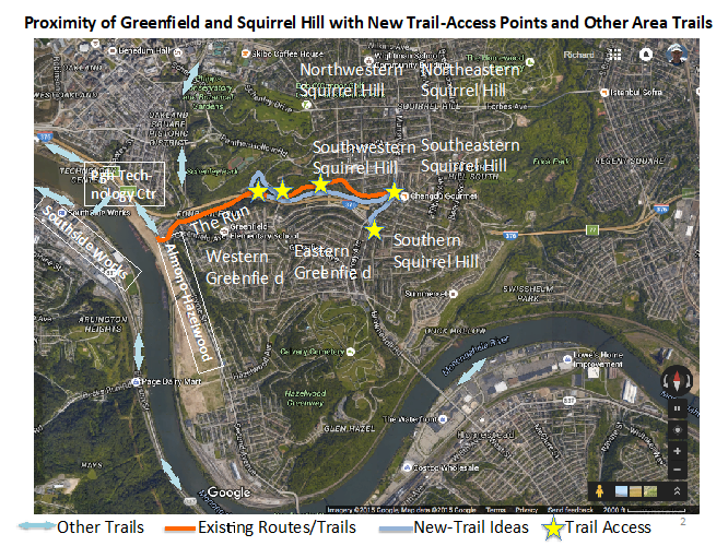
Figure 1: New-Trail Idea in Relation to Greenfield, Squirrel Hill, Existing Trails and Developments
Description of the Pedestrian-Bicycle Route Idea
The following describes the proposed route between the Beechwood Blvd. and Monitor St. intersection westward to The Run section of Greenfield.
The route would begin at the intersection of Beechwood Blvd. and Monitor St. at the Greenfield-Squirrel Hill border. It would complete a now-missing sidewalk along the north face of Beechwood Blvd. in the area; it would be built wide enough to handle bicycles as well as pedestrians. From Monitor Street, it would traverse a City-owned parcel, and then proceed through the Buncher site, which is the location of the newly approved medical marijuana dispensary. The developers of the dispensary have agreed to implement their portion of the ped-bike route through the property.
From the location of the dispensary, the route would proceed as a bike track along the east face of lower Forward Ave., through the Forward-Murray-Pocusset intersection along a now missing crosswalk that needs to added crossing lower Forward Ave., and then as a second bike track along the west side of lower Forward Avenue until it connects adjacent to the Lifetime Automotive property. The two bike tracks along lower Forward Avenue would not only facilitate the ped-bike route, but would also provide traffic calming which is a need at this location. The design of the bike track along the east side of lower Forward Ave. would need to be interfaced with the curbside parking that is located there.
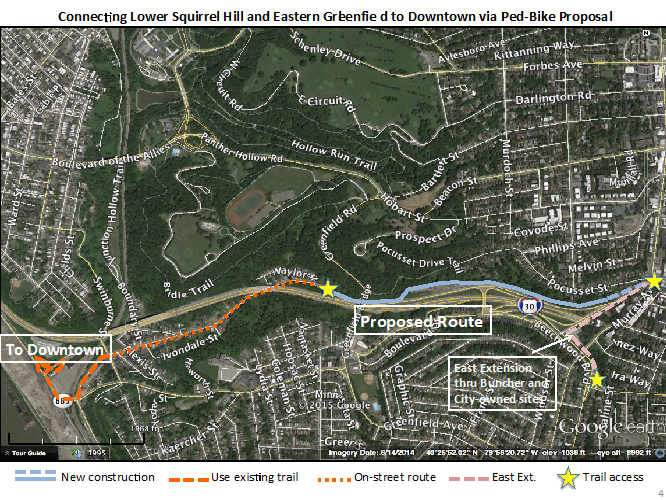
Figure 2: Proposed Pedestrian-Bicycle Connection Between Lower Squirrel Hill and Saline Street
From adjacent to the Lifetime Automotive property, the ped-bike route would be built as an exclusive pedestrian-bicycle trail to Saline Street in The Run section of Greenfield. The dedicated trail would travel westward alongside and just north of I-376, under the new Greenfield Bridge, and descend 35 feet to an intersection with Saline Street in The Run.
(Note: It may be possible to use a different alignment between F-M-P and The Run, one which would use existing Pocusset Street. For simplification purposes, this paper describes the alignment that runs adjacent to I-376, rather than along Pocusset St. By conducting an environmental and engineering study of the pedestrian-bicycle trail/route proposal, it is possible to study the two alignments.)
After connecting with Saline Street, the proposed pedestrian-bicycle alignment would use existing streets, bike lanes and bike tracks to connect with the head of the Eliza Furnace Trail. In addition to serving The Run and connecting Greenfield and Squirrel Hill to the regional trail system, the proposed routes would also connect with the Pittsburgh Technology Center, Southside Works, and the Almono development currently underway at the northern tip of the Hazelwood neighborhood.
Interface of Route with the Marijuana Dispensary Site and the F-M-P Intersection
An important consideration is how the proposed route would interface with southern Squirrel Hill and eastern Greenfield, particularly the F-M-P intersection, which is a focal point of the area, and is the location of a number of new development projects including the state-licensed medical marijuana dispensary that will be developed on the Buncher site, and which lies directly along the proposed trail/route.
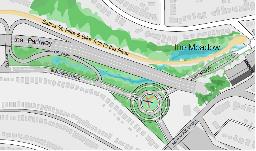
Describing the route from west to east in Figure 3, the ped-bike route would be in the form of an exclusive pedestrian-bicycle trail in the location shown as a blue line in Figure 3. At approximately adjacent to the Lifetime Automotive parking lot, the design would transition to a bike track that would be used by bikes and is adjacent to the sidewalk that would be used by pedestrians. This bike track would directly access the F-M-P intersection.
To pass through the intersection, the now missing crosswalk at the F-M-P intersection would need to be implemented, because the route would utilize this crosswalk. (Bicyclists would need to dismount and walk their bikes through the intersection.)
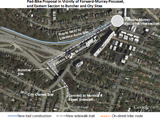
Figure 3: Pedestrian-Bicycle Route in Vicinity of F-M-P Intersection
Importance of Improving the F-M-P Intersection
The proposed pedestrian-bicycle route would need to directly access and pass through the F-M-P intersection. However, because the intersection is not optimally designed for pedestrians and bicyclists, it is necessary that the intersection be improved for these users through a combination of traffic signal re-design including revamping the pedestrian crossing aspects, re-striping to better delineate pedestrian crossings and to channel traffic, etc.
One critical aspect that needs to be improved is the lack of a pedestrian crossing of the southern leg of Forward Avenue at the 5-leg intersection. Because of this “missing” sidewalk, pedestrians must cross the other four legs of the intersection, requiring more than 5 minutes in duration, in order to “cross the street.”
East of the F-M-P intersection, the route would be in the form of a bicycle track would proceed southward. Bicycles would use the bicycle track and pedestrians would use the adjacent sidewalk. At the intersection of Forward and Beechwood Boulevard (the Buncher site), the route would turn eastward. The route would utilize a portion of the Buncher property and would comprise what is now a missing sidewalk along the north side of the Beechwood Boulevard right-of-way. The developer of the dispensary has agreed to implement the ped-bike trail through their site. Traveling eastward from the Buncher site, the route would utilize City of Pittsburgh property where again it would be adding a sidewalk to where there is not one now. Where the City’s property intersects with the intersection of Monitor Street, the route would connect with the existing sidewalks.
It should be noted that in addition to providing a needed facility for pedestrians and bicyclists, the route through the Buncher site and adjacent City-owned site would provide needed access to the dispensary site, and would connect with a bus stop at Beechwood and Monitor that serves buses that carry nearly 3,000 daily riders. This piece of the trail/route would connect together Greenfield and Squirrel Hill, thereby eliminating a 1-mile detour that currently exists for wheelchairs, other pedestrians, and bicyclists.
Potential Pedestrian-Bicycle Route to Improve Transportation Access in Greenfield and Squirrel Hill, and Provide Access Through Buncher Site
Squirrel Hill
Enter your email address to subscribe to our newsletter and receive notifications of new posts by email.
this is a test
this is a test